


Le Taillefer depart La Blache 1333+

claude nier
User
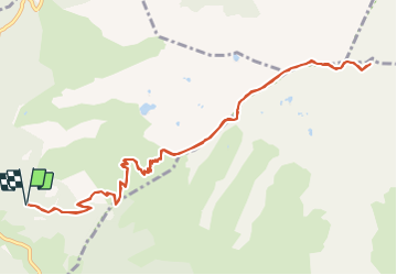

Length
13.5 km

Max alt
2851 m

Uphill gradient
1333 m
Km-Effort
31 km

Min alt
1527 m

Downhill gradient
1336 m
Boucle
Yes
Creation date :
2021-08-22 15:03:46.965
Updated on :
2021-08-22 15:04:57.855
7h06
Difficulty : Difficult

FREE GPS app for hiking
 SityTrail
IGN / Geographical institutes
SityTrail Plus
The world is yours!
About
Trail On foot of 13.5 km to be discovered at Auvergne-Rhône-Alpes, Isère, La Morte. This trail is proposed by claude nier.
Description
Petite rando sympa
beaux paysage
Fait solo
A refaire
Positioning
Country:
France
Region :
Auvergne-Rhône-Alpes
Department/Province :
Isère
Municipality :
La Morte
Location:
Unknown
Start:(Dec)
Start:(UTM)
726147 ; 4989610 (31T) N.
Comments